Gas utilities face a constant challenge: maintaining and upgrading infrastructure while working to keep costs under control. One common cost driver is excavation. Digging blindly or with outdated maps can lead to unnecessary costs, disruptions, and even safety hazards. In-pipe precision mapping solutions are helping utilities reduce excavation, streamline projects, and improve overall operational efficiency.
The High Cost of Utility Excavation
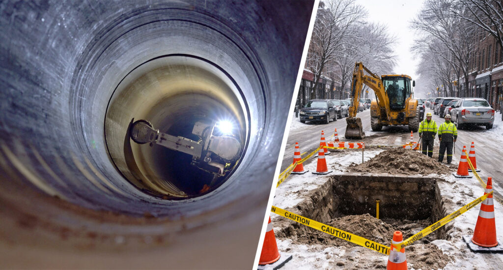
When utilities excavate without an accurate underground view, they risk increased labor costs, equipment expenses, and potential damage to existing infrastructure. A complete picture of the gas mains and services within the excavation area is the only way to reduce these risks.
Beyond the direct costs, unnecessary excavation carries indirect expenses as well. Road closures, service interruptions, and potential third-party damages add complexity and liability to every dig.
Reliable, up-to-date mapping helps reduce the risk of incurring these unnecessary costs.
Precision Mapping and Locating
Gas main mapping and locating is the process of identifying the precise position, depth, and layout of underground gas distribution networks. Utilities rely on accurate pipeline mapping for situational awareness in order to prevent accidental damage, improve safety, and minimize excavation costs.
With aging infrastructure and increasing urban development, gas line mapping and locating have become more critical than ever. When utilities have precise digital records of their pipeline networks, they can streamline planning, reduce disruptions, and improve safety. Accurate gas line mapping has become essential for efficient infrastructure management.

Key Benefits of Utility Mapping
Precision mapping enhances the overall efficiency and safety of gas utility operations. With the right mapping and locating programs, utilities can maintain pipeline infrastructure with confidence. Benefits of updated, precise, accessible network maps include:
Precision mapping enhances the overall efficiency and safety of gas utility operations. With the right mapping and locating programs, utilities can maintain pipeline infrastructure with confidence. Benefits of updated, precise, accessible network maps include:
1. Reduce Excavation Costs
Pinpoint accuracy means fewer unnecessary digs. With precise mapping, crews know exactly where to dig—and, more importantly, where not to dig—saving both time and money.
2. Minimize Risk of Third-Party Damages
Excavation accidents are costly and dangerous. By accurately identifying underground assets, utilities can prevent accidental line strikes and reduce the risk of service disruptions and costly repairs.
3. Enhance Regulatory Compliance
Utilities must adhere to strict safety and reporting regulations. Updated digital maps help companies meet compliance requirements and provide necessary documentation for audits, safety inspections, and infrastructure planning.
4. Improve Emergency Response
In-pipe mapping can identify leak-prone features such as plugs or abnormal pipework that may be the source of gas readings. Having precise, up-to-date network maps allows utilities to implement a faster gas leak emergency response and take immediate action to prevent further hazards.
5. Future-Proof Infrastructure
Reliable mapping ensures that distribution maintenance, replacement, and upgrade projects proceed smoothly, reducing delays and unexpected costs.
Challenges of Excavating Around Gas Distribution Mains
Excavating around gas lines presents several challenges that, without the right mapping, can lead to safety risks and increased costs for utilities. Here are some of the most common challenges:
- Outdated and missing records lead to inaccurate mark-outs
- Not all pipeline features — like stub services or fusions — are included on records
- Unmapped stub services are at high risk of damage
- PE pipe with no tracer wire or a broken tracer wire are hard to locate
These challenges can be overcome with advances in technology and the right service partner.
A Better Option: In-Pipe Locating and Mapping
In-pipe mapping technology allows gas distribution utilities to see exactly what’s underground—joints, couplings, PE lines, and more. By deploying camera and crawler systems directly into gas mains and services, utilities can walk away with a detailed, accurate map of the pipeline’s location, depth, and features—all without shutting down service.
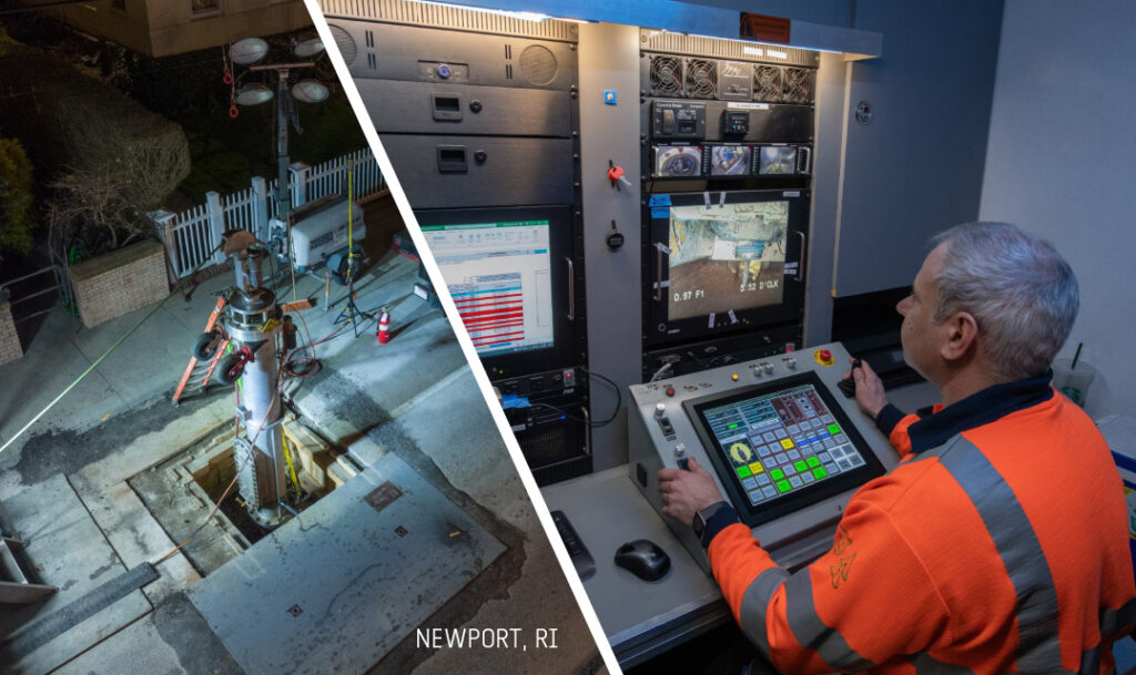
In-pipe mapping and locating differs from standard one-call locating practices because it involves a locatable live gas inspection camera to be inserted into the gas main or gas service. From the street surface, a second technician pinpoints the location of the camera from above ground and captures that location as mark-out, measurements, or GPS. This allows the team operating the in-pipe mapping solution to deliver precise locates on the gas pipeline as well as any features visible within the gas pipeline.
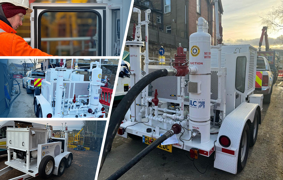
Advanced in-pipe mapping and inspection service eliminates guesswork and provides real-time, actionable data. ULC Technologies uses our camera and crawler systems to visually inspect the main or service and capture photos and videos from within the main. This is then used to provide operations and engineering teams with highly detailed records that improve project planning and reduce occurrences of rework due to inaccurate maps.
This approach solves many of the challenges of traditional mapping methods.
All Work Performed in Live Gas
Our camera and crawler systems are designed for safe use in live gas, so customers continue to receive service while inspections and mapping take place.
Capture Pipeline Features
Utilities, contractors, and stakeholders often need to know more than just the location of the gas main. With in-pipe camera access, all taps, joints, offsets, valves, and service connections can be precisely marked and mapped. With this valuable information, crews have a complete picture of the underground infrastructure.
Locate Non-Metallic Pipes
One of the biggest challenges in pipeline locating is finding non-metallic pipes, such as Aldyl-A and polyethylene (PE) mains where there was no tracer wire installed or the tracer wire is no longer functional. Unlike metallic pipelines, these materials are nonconductive, making them invisible to most standard locating equipment, which relies on electromagnetic (EM) fields to bounce back signals.
In-pipe locating methods enable gas utilities to effectively and efficiently locate PE pipe as well as any features visible within the pipe. Additionally, live gas main inspection cameras are able to achieve greater push distances in PE—including the ability to push the camera 400ft in a 2” PE pipe.
Cloud-Based Data Management
ULC’s mapping service doesn’t just capture data—we make it instantly accessible in a cloud-based dashboard. Utility teams can review inspection footage, generate reports, and manage large-scale mapping projects with ease. This information, along with precise GPS data, can be passed off to crews in the field.
In-Pipe Inspection in Action
There are many different ways ULC’s in-pipe inspection and mapping services help utilities reduce excavation, minimize damages, and improve project planning. We have worked with utilities in varying situations to inspect pipelines with our camera and robotic crawler systems, helping each one save time, lower costs, reduce risks, and improve safety.
Identifying Gas Line Features
By working with ULC, a West Coast gas distribution utility was able to significantly reduce excavation costs while ensuring distribution integrity. Instead of digging hundreds of unnecessary trenches, the utility pinpointed the exact locations of outdated couplings in its 2-inch PE gas mains.
Over 12 days, ULC’s team performed inspections with minimal excavation, requiring just 34 pits to cover more than 2 miles of pipeline. This precise method not only saved the utility substantial costs by eliminating guesswork but also avoided any disruption to service.
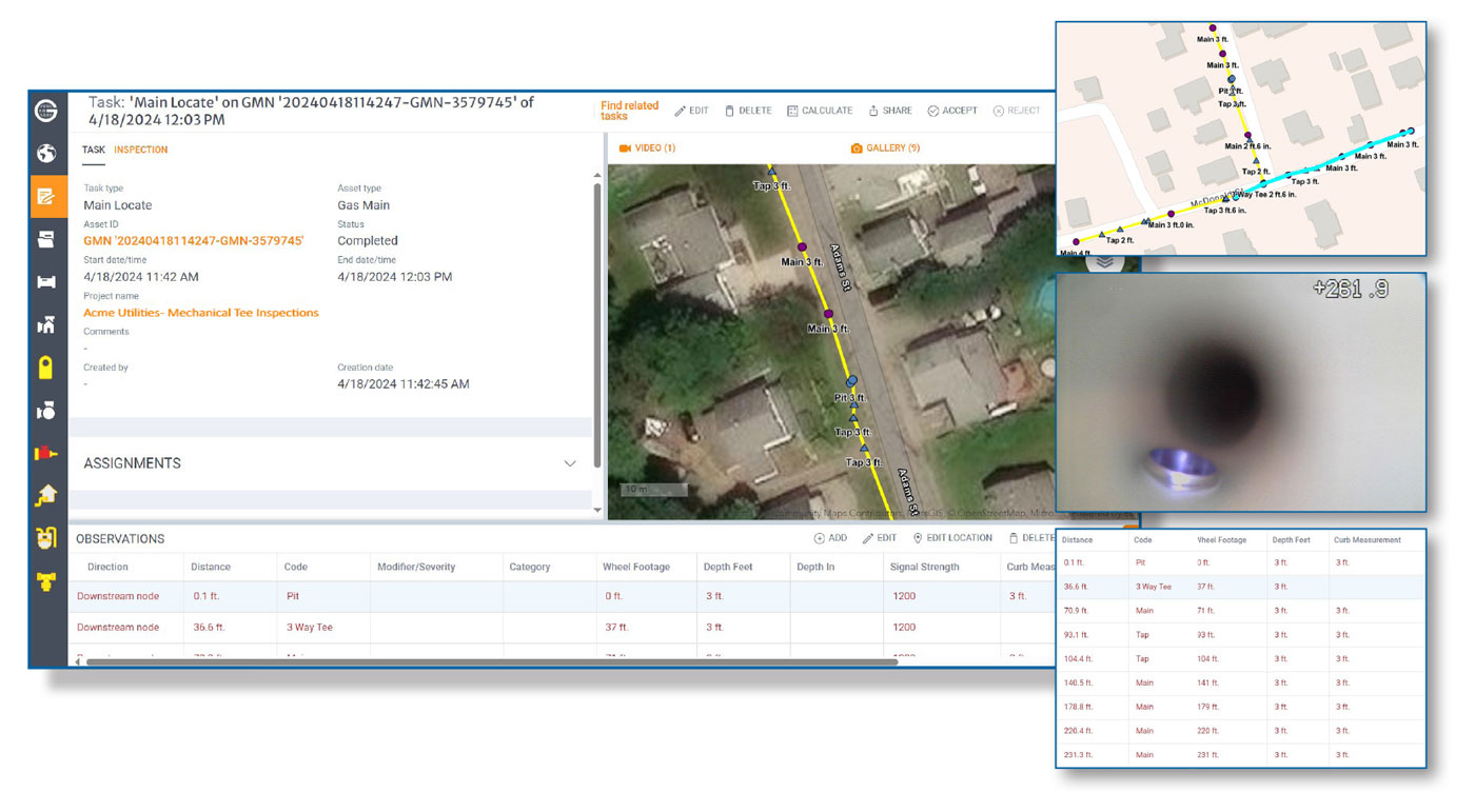
Inspecting Mechanical Tee Installations
A northeastern U.S. gas utility was able to verify the installation of mechanical service tees while drastically reducing excavation costs and disruptions. After discovering one improperly installed tee, the utility needed to inspect every service tee across 20,000 feet of new PE gas main.
With ULC’s live gas main inspection technology, they reduced excavation by 87%, only requiring 38 pits instead of hundreds. The precise camera inspections identified 35% of tees that didn’t meet safety standards, enabling the utility to efficiently target excavation locations without any service disruption to customers.
Removing Excavation Guesswork
A California utility faced challenges locating and inspecting butt fusion welds in their newly installed 2″ MDPE gas pipeline. Because some records were missing, excessive excavation and guesswork were causing delays. By inspecting 2,700 feet of pipeline through just five excavations, we identified and marked out nine butt fusions, even finding more than initially anticipated. With this information, contractors were able to safely and precisely dig over each fusion, reducing unnecessary excavation.
Contact our team today to learn more about our advanced live gas main locating technology and services.